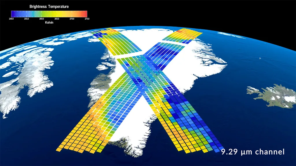
Two complete seasonal cycles observed by NASA's PREFIRE mission are giving researchers a new view of how temperatures and outgoing heat change across the Arctic and Antarctic. NASA Earth Observatory released animations on August 7 built from measurements collected since the mission's twin CubeSats began science operations in July 2024.
The maps show surface temperatures pulsing through opposing seasons in the two hemispheres. Arctic winters give way to summers that thaw tundra and sea ice across large areas. Antarctica remains much colder, with most of the continent staying below freezing even during its summer.
PREFIRE stands for Polar Radiant Energy in the Far-InfraRed Experiment. Its instruments measure wavelengths longer than 15 micrometers, often described as far-infrared radiation. NASA says this part of the spectrum accounts for nearly 60 percent of the energy Earth emits to space. Clouds and water vapor can absorb and re-emit that radiation.
Earth's polar regions are central to the planet's energy balance. Atmospheric and ocean circulation carry some of the excess heat absorbed in the tropics toward higher latitudes, where energy can eventually escape to space. Better observations can help researchers test how accurately models represent clouds, ice, moisture and heat transport.
The mission's two small satellites travel in asynchronous near-polar orbits. Passing over similar locations at different times allows them to observe changes that may occur over hours as well as through the seasons. NASA expects those measurements to help study short-lived processes alongside longer records.
The newly released animation is primarily a visualization of seasonal temperature behavior, not by itself a measurement of a long-term warming trend. Two years is too short to establish many climate trends. Its value lies in providing repeated direct observations of a previously under-measured energy pathway.